The Turkish Trans-European Transport (TEN-T) Highway Network
|
The purpose of the TEN-T (Trans-European Transport Network) in Turkey is to articulate a good transport infrastructure to the European transport networks through forming this transport structure to facilitate free movement of persons, goods, and service between Turkey and the countries of the EU. Our country pay great importance to the formation of fast, safe multi-modal transport infrastructure and the facilitation of requisite transport linkages between the areas of the Black Sea, the Middle East, the Mediterranean and Europe.
With the Transport Infrastructure Needs Assessment (TINA Turkey) study that was carried out between December 2, 2005 and July 10, 2008 within the framework of TEN-T, the corridors and priority infrastructure investment needs which will improve these corridors were defined. The Infrastructure projects which were prioritized with the forementioned study and which aims to construct core network are financed through the EU funds.
The map of TEN-T of Turkey was prepared within the studies on the scope of "Trans-European Networks Chapter 21" and was approved in the ministerial meeting which was held on June 21, 2016 in Rotterdam. The maps are going be attached to the related EU regulation after the completion of internal procedure of the EU.
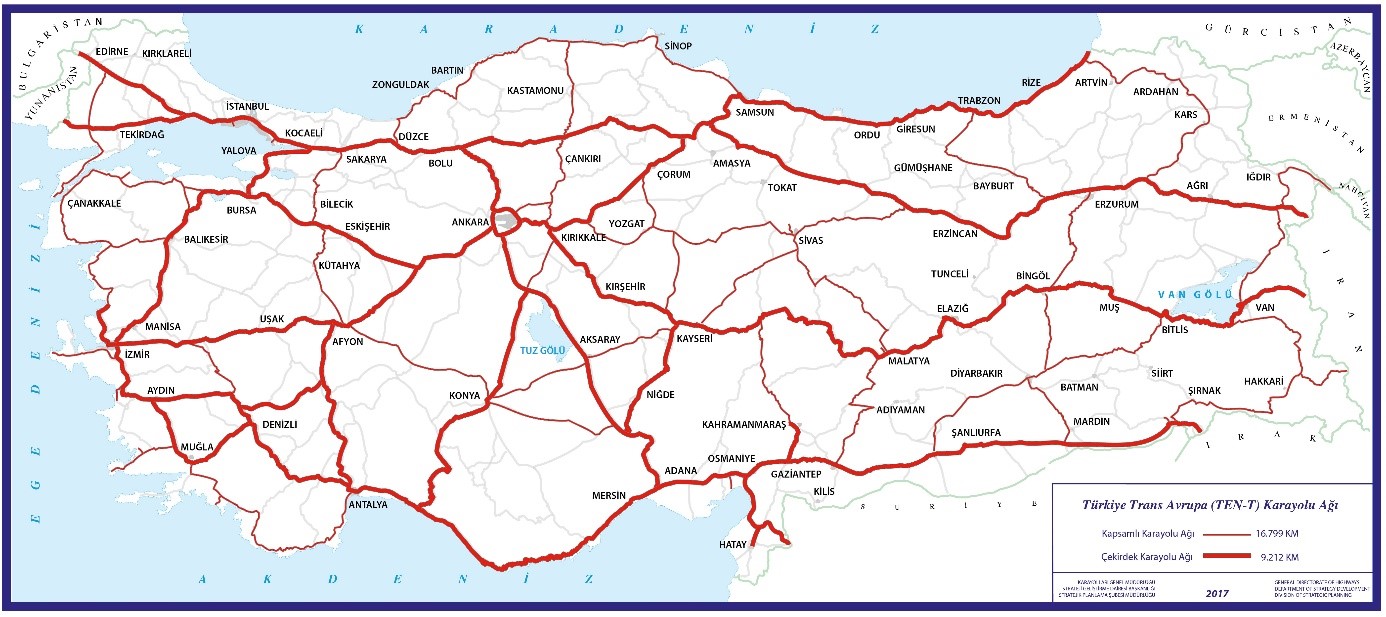
Within this scope, the map of TEN-T Highway Network of Turkey was prepared in two different categories as the Comprehensive Highway Network and Core Highway Network through taking TINA Study as the base in the framework of "TEN-T Guidelines" which were defined by the European Commission. Core Highway Network comprises highway infrastructures which are strategically most important and have priority with respect to investment while the Comprehensive Highway Network comprises highway infrastructures which have secondary importance.
In addition, Transport Information Management System Project (TIMS), which was prepared with the purpose of storing transport data regarding Turkey's TEN-T network in a system based on Geographic Information Systems, mapping of these data, analyzing them, making these data capable of providing recommendations to the decision makers, and communicating these data to the European Union and which was realized by using EU funds, started on June 14, 2016 and completed on November 23, 2017.
Total length of TEN-T Turkey Comprehensive Highway Network is 16,799 km. TEN-T Turkey Highway Network consists of 9,212 km of Core Highway Network.